Tuesday, January 24, 2017

How to add spatial data to GeoServer

In this post we will learn how to add spatial data to the GeoServer.

 Following link will teach you how to download and install GeoServer.
http://effective-gis.blogspot.com/2016/06/geo-server.html

Step 1,
Run GeoServer


Step 2,

To add new data source first we have to create new "workspace" in the GeoServer, 


Click on the "Workspaces" and you can see existing workspaces. 

Step 3,

Click on the "Add New Workspace"


Step 4,

Assign any name as you wish for the workspace name and assign relevant name after the http://geoserver.org/       in "Namespace".


Step 5,

Then we can enable WFS, WCF,WMS services, and we can add the name, contact, e-mails etc... 


Step 6,

Press save button and you can see newly created workspace been added to the Workspaces


Step 7, 

After creating workspace we have to create store to add data, then click on "Add new store",


Step 8,

In this practical we are adding an ESRI shapefile, hence select ESRI shapefile option in the view,


Step 9,

Select created workspace to add new data from the drop down list,


Step 10,

Type name of the data source (you can give any name as your wish) and always better to give related description about the data,


Step 11,

Then press "Browse" to select the required shapefile to be added, then press save.


Step 12,

We have to publish the added data in-order to display in the server. Press "publish"


Step 13, 

Press "Data" tab and fill where necessary and we have to concern more on Coordinate system (SRS). we can select required coordinate system by clicking on "Find"button. 


Then click on click on "compute from data" to generate bounding box,


Step 14,

Then select "Publishing"  tab and fill required fields which is not mandatory in this stage. Once you finish press save.


Step 15, 

Newly created data layer will be displayed in "Layers".
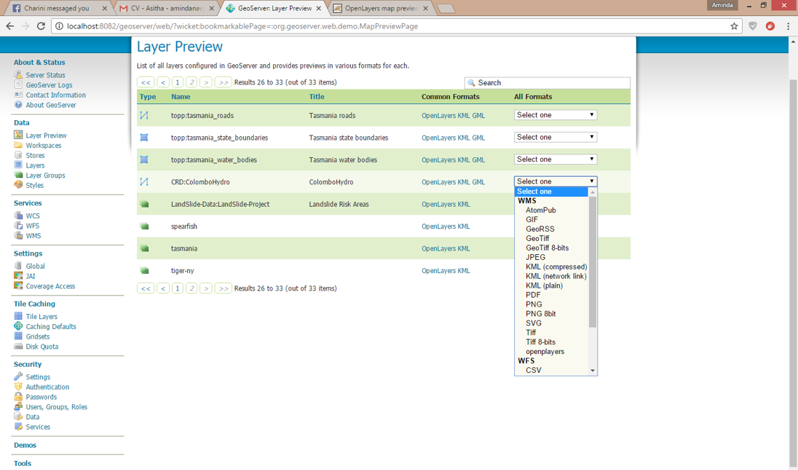


Step 16,

Select "Layer Preview" to view the added data in GeoServer.


 Select OpenLayers option to view the data as an openlayer,


Click over the data layer to view the attributes.                                                                           

Click on "Toggle option toolbar " to add toolbar to the viewer. 

We can change the width and the height and many other options using toggle editor tool bar.      


Step 17,

We can download KML file directly from the GeoServer by clicking on the KML option.


Step 18,

We can download data in many formats from the GeoServer and in the next post we will learn how to connect to the GeoServer through Local host and from a different Network.


Sunday, January 15, 2017

How to use osm2pgsql for loading raw OSM data into a Postgresql database in Windows

In this post we will look at how to use osm2pgsql, a command-line program for loading raw OSM data into a PostGIS database. In order to  get OpenStreetMap data into a database, you could create a Postgresql PostGIS enable database in which you can store geographic data. 

You can find the step to set up Postgresql with PostGIS in Windows in this blog post.

Follow below steps to set up osm2pgsql on Windows , we assume that you have set up PostGIS database(s) correctly and later will give you some tips on that.

Get OSM2PGSQL

Step 1

osm2pgsql can be downloaded  from here and if you want, there are many builds available in internet.
https://github.com/openstreetmap/osm2pgsql

Step 2


Download the .zip  file and unzip it in a location where you will  not change later .To import data from OSM you have to run a program called osm2pgsql.exe in the extracted  folder. Extracted folder location will add to system path later.
Make sure that custom style file is in the extracted folder . This custom style file define which tags are included in the database during import


Set System Path 

Step 1

Go to Settings-> Settings->PC info-> Advanced system settings.


Click  "OK"  several times to  save new settings

Step 2


You can check the functioning of osm2pgsql using Windows Command Prompt


If you are getting something similar to this , then osm2pgsql  works fine

Getting Raw OSM Data

Before starting we need to  have some raw OSM data to import into  a database. This can be downloaded from OSM or  https://mapzen.com/data/metro-extracts/  which  host many OSM extracts all over the world.

Import Raw OSM data 

Step 1

Before importing data open PgAdmin III and create a new database named gis with superuser ownership.Then run osm2pgsql program via the command line .


We need to provide at least 
  • The location of the OSM Data File
  • Name of the database and username
  • Location of the style file
Step 2
Run following command replacing location of the OSM Data File  and location of the style file.

osm2pgsql -c -d gis -U postgres -H localhost -S C:\default.style C:\osm2pgsql\TryOSM.osm

Step 3

It takes time to load all data into the database. If everything works fine then you will get  something similar to  this.


Testing Data

We can view the data in our database using QGIS if the import was successful .


Follow below steps to  view the data in QGIS


  • Open QGIS and click on "Add postGIS Layer" In the connection bar click "New"


  • Enter username as "postgres" and your password


  • Click "OK" to save the connection settings and then click "Connect " to  connect  to  your PostgreSQL server.
  • Click next to  see "public" and expand it to see all the layers (tables) in your database .
  • There you can see a separate table for each object types-points, lines and polygons.


  • Select layers and click "Add". Choose WGS84  as the CSR.
  • If everything works fine, you will see the layers you selected displayed in QGIS.


Tuesday, June 21, 2016

GeoServer

GeoServer is a Java-based software server that allows users to view and edit geospatial data.  User must ensure JAVA is running on the computer before installing Geo Server and Apache Tomcat must be installed. 

Step 1,

Download Geo server (Stable version) from following link

http://geoserver.org/download/


Step 2,

Make sure Java is running on the computer or else install Java using JAVA SDK. 

Step 3,

We must create runtime environment for Java,

Go to My computer properties-  Advance system settings - Environment variables - New user variable 

Variable Name - JRE_HOME
Variable Value - C:\Program Files\Java\jre1.8.0_60


Step 3,

Copy Apache Tom Cat in to "C" drive


Step 4,

Copy and paste geoserver.war file into tomcat webapps. If the .war file is not available in the geoserver folder download it in the following link.
http://geoserver.org/release/stable/


Step 5,

Run startup.bat file in the Apache bin using command prompt.


Step 6,

Do not close the Tomcat and type following link in your web browser.

localhost:8080/geoserver/web

user name - Admin
password - Geoserver


Monday, June 6, 2016

Spatial Temporal analysis in QGIS

When we need to analyse spatial data which are changing it's locations with the time we have to use temporal analysis tools. Also this refers as tracking analysis. QGIS plugin "Time Manager" allows users to analyze  spatial data with the time. 


Step 1,

Open QGIS - Plugins - search "Time Manager" - Install the plugin


Step 2,

Add vector data layer which contain time/date as attribute


Step 3,

Open Time Manager plugin


Step 4,

Click on the "Settings' button in the Time manager and add data layer. then select the field where time values are stored


Step 5,

Change the time duration as required (Min, hours, day etc...)


Step 6,

Now we can run the analysis, just click on the play button


Step 7,

Click export button to export the analysis as video file